Athens is walkable, packed with history, and buzzing with life—but it’s easy to get turned around without a plan. Whether you’re here for ruins, food, or culture, this Athens map guide breaks down the neighborhoods, must-see spots, and smart routes to help you navigate like a local.
Get To Know The Traveling Taylors!
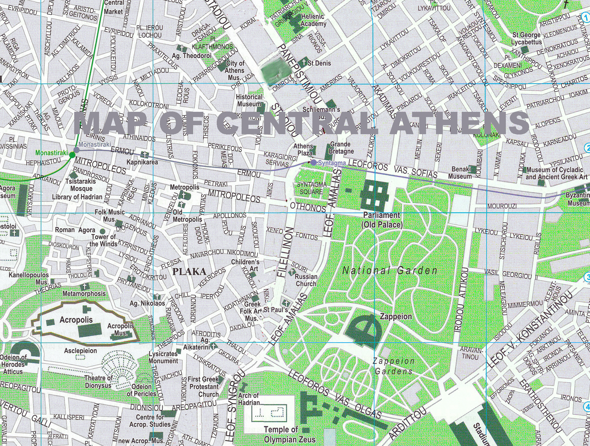
Athens Map Overview: Main Neighborhoods
- Plaka: The historic heart, filled with neoclassical homes, souvenir shops, and tavernas.
- Monastiraki: Known for its flea market, square, and access to ancient sites.
- Koukaki: A relaxed, local-feel area close to the Acropolis.
- Psiri: Artsy and hip with nightlife, bars, and creative vibes.
- Syntagma: Central square with Parliament and metro access.
- Exarchia: Edgy, student-filled, and full of street art and cafes.
If you’re visiting multiple attractions throughout the day, attaching an Apple AirTag like this one to your bag or luggage can give you peace of mind in case something gets misplaced.
Top Sights to Map Out
- Acropolis & Parthenon: Iconic and centrally located above Plaka.
- Acropolis Museum: Just southeast of the hill, walkable from Plaka or Koukaki.
- Ancient Agora: West of the Acropolis, near Monastiraki.
- Roman Agora & Tower of the Winds: Tucked into Plaka.
- Mount Lycabettus: Northeast of the center; hike or take the funicular.
- National Garden & Zappeion: A shady escape near Syntagma.
Many travelers love bringing an instant camera like this one to capture fun memories at famous landmarks and print photos on the spot.
Best Walking Routes in Athens
- Plaka → Acropolis → Monastiraki Loop: Takes you past ruins, shops, and food spots.
- Koukaki → Acropolis Museum → Dionysiou Areopagitou Street: A scenic, pedestrian-friendly path lined with performers and views.
- Psiri → Ancient Agora → Roman Agora → Plaka: Historic and hip with plenty of food breaks.
Using the Metro to Map Your Moves
- Line 2 (Red): Connects Acropolis, Syntagma, and Omonia.
- Line 3 (Blue): From the airport to central Athens (Monastiraki, Syntagma).
- Tip: Download an offline map or use Google Maps—Athens metro is tourist-friendly.
Getting around the city is fairly straightforward thanks to its extensive public transportation system, and many travelers like using a secure phone holder like this one so they can easily follow navigation directions while walking or riding around.
Athens Is Easier with a Good Map
With the right Athens map and a sense of direction, the city opens up fast. Use this guide


Share your thoughts with us! Leave a Comment!