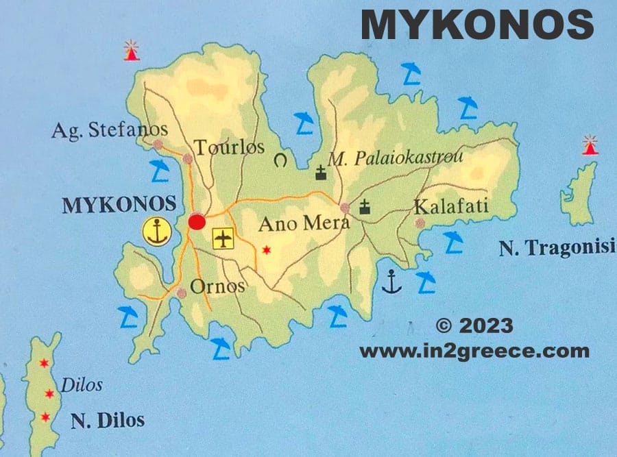
When we first visited Mykonos, one of the most helpful things we looked at was a Mykonos map. The island may look small, but the winding roads, scattered beaches, and hillside villages can make navigation surprisingly tricky.
Get To Know The Traveling Taylors!
Understanding a Mykonos map before your trip helps you choose the right hotel area, plan transportation, and avoid spending too much time traveling across the island. This beginner-friendly guide explains exactly how to read a Mykonos map and what areas first-time visitors should know.
Understanding the Layout on a Mykonos Map
At first glance, a Mykonos map shows a roughly circular island with beaches scattered around the coastline and one main town at the center.
The most important location you’ll see on any Mykonos map is Mykonos Town (also called Chora). This is the island’s main hub for restaurants, shopping, nightlife, and transportation.
Most roads on the Mykonos map branch outward from this central area toward different beaches and hotel zones. Because of this layout, staying near Mykonos Town often makes exploring the island easier. Comfortable shoes are essential when exploring Mykonos on foot, and many travelers recommend supportive walking sneakers like these for full days of sightseeing.
Quick Tip:
If it’s your first visit, choosing accommodation close to the center of the Mykonos map helps reduce travel time.
Key Areas to Know on a Mykonos Map
A good Mykonos map highlights several important areas travelers often visit. Understanding these locations makes planning your itinerary much easier.
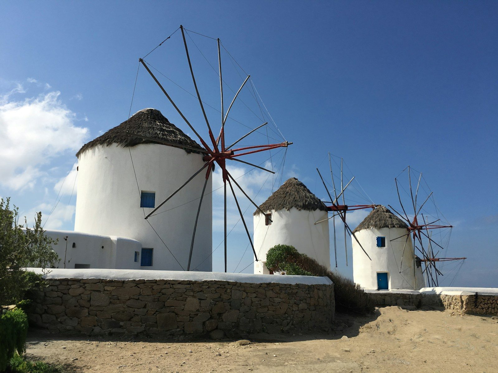
Mykonos Town (Chora)
The heart of the island on every Mykonos map is Mykonos Town.
This area is known for:
- Whitewashed buildings and narrow streets
- Iconic windmills overlooking the sea
- Restaurants, boutiques, and nightlife
Most ferries, buses, and taxis operate from here, making it the transportation hub of the Mykonos map.
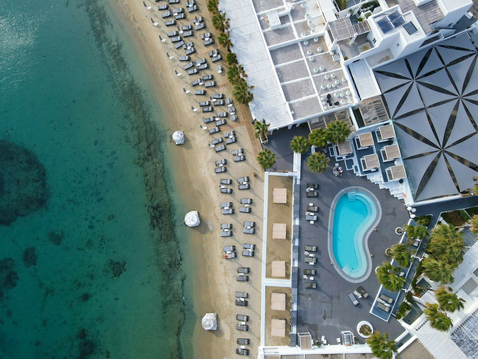
Ornos Beach
Located just a short drive from town, Ornos is another key location you’ll see on a Mykonos map.
Travelers often choose this area because it offers:
- Calm, swimmable water
- Excellent beachfront restaurants
- Easy access to Mykonos Town
It’s one of the most convenient beach areas marked on a Mykonos map. Many travelers pack a versatile one-piece swimsuit like this one for beach days or water activities at Ornos Beach.
Psarou and Platis Gialos
On the southern coast of the Mykonos map, you’ll find two popular beach areas: Psarou and Platis Gialos.
These areas are known for:
- Crystal-clear water
- Beach clubs and luxury hotels
- Water taxis connecting nearby beaches
Many visitors explore this part of the Mykonos map during the day before returning to town for dinner. Because you’ll likely be outside for hours visiting these beaches, bringing UV-protective sunglasses like these can help keep your eyes comfortable throughout the day.
Beaches You’ll Notice on a Mykonos Map
If you look closely at a Mykonos map, you’ll notice that many of the island’s best beaches are on the southern coastline. These beaches are more protected from wind, which makes swimming easier.
Some of the most popular beaches marked on a Mykonos map include:
- Paradise Beach – famous for beach parties
- Paraga Beach – relaxed beach clubs and great swimming
- Elia Beach – one of the largest beaches on the island
- Agios Stefanos – close to the port and quieter than many others
Because these beaches are spread out, a Mykonos map can help you plan which ones to visit each day. Protecting your skin from the sun is essential when visiting these beaches, and many travelers rely on SPF 50 sunscreen sprays like this one for quick and easy coverage.
Transportation Routes on a Mykonos Map
Another reason a Mykonos map is helpful is understanding how transportation works on the island.
Most routes connect through Mykonos Town, so many buses and taxis start or end there. When reviewing a Mykonos map, you’ll notice the main road loops around the island with smaller roads branching off to beaches.
Travelers typically explore the Mykonos map using:
- Local buses connecting major beaches
- Rental cars or ATVs – Many travelers like using a secure phone holder like this one in their rental cars so they can easily follow navigation directions while riding around.
- Taxis and private transfers
If you plan to visit multiple beaches, looking at a Mykonos map beforehand can save time and help you organize your route.
Simple Tips for Using a Mykonos Map
A Mykonos map becomes much easier to understand once you know what to look for.
Keep these simple tips in mind:
✔ Stay near the center of the Mykonos map if you want easy transportation
✔ Use the southern beaches for calmer swimming conditions
✔ Plan beach visits by grouping nearby locations on the Mykonos map
✔ Check distances between areas before booking your hotel
Even a quick glance at a Mykonos map can make navigating the island far easier. Staying hydrated during long sightseeing days is important, so many travelers carry a collapsible water bottle like this one that folds flat when it’s empty.
Why Every Traveler Should Check a Mykonos Map
Although Mykonos is small, having a basic understanding of a Mykonos map can make your trip much smoother. Knowing where the main town, beaches, and roads are located helps you plan better days and avoid unnecessary travel time. Before booking your hotel or planning beach visits, take a few minutes to study a Mykonos map. That simple step can help you experience the island more easily and make the most of your time exploring one of Greece’s most famous destinations.


Share your thoughts with us! Leave a Comment!