
When we first started planning our trip, looking at a map of the Canary Islands made one thing very clear — these islands may belong to the same archipelago, but they are completely different from one another.
Get To Know The Traveling Taylors!
Some islands are packed with beach resorts and nightlife, while others are quiet volcanic landscapes perfect for hiking and nature. Understanding a map of the Canary Islands helps travelers choose the island that matches their travel style and avoid common planning mistakes.
When moving between busy transportation hubs, many travelers prefer keeping important items in a slim running belt like this one so their phone, cards, and passport stay secure while navigating crowds.
Before booking flights or ferries, it’s worth studying the map of the Canary Islands to understand where each island sits and what it’s known for.
Understanding the Layout on a Map of the Canary Islands
A map of the Canary Islands shows the archipelago stretching across the Atlantic Ocean just west of northwest Africa. The islands are usually divided into two main groups.
Western Islands
• Tenerife
• La Palma
• La Gomera
• El Hierro
These islands are generally greener, more mountainous, and ideal for nature lovers.
Eastern Islands
• Gran Canaria
• Fuerteventura
• Lanzarote
• La Graciosa
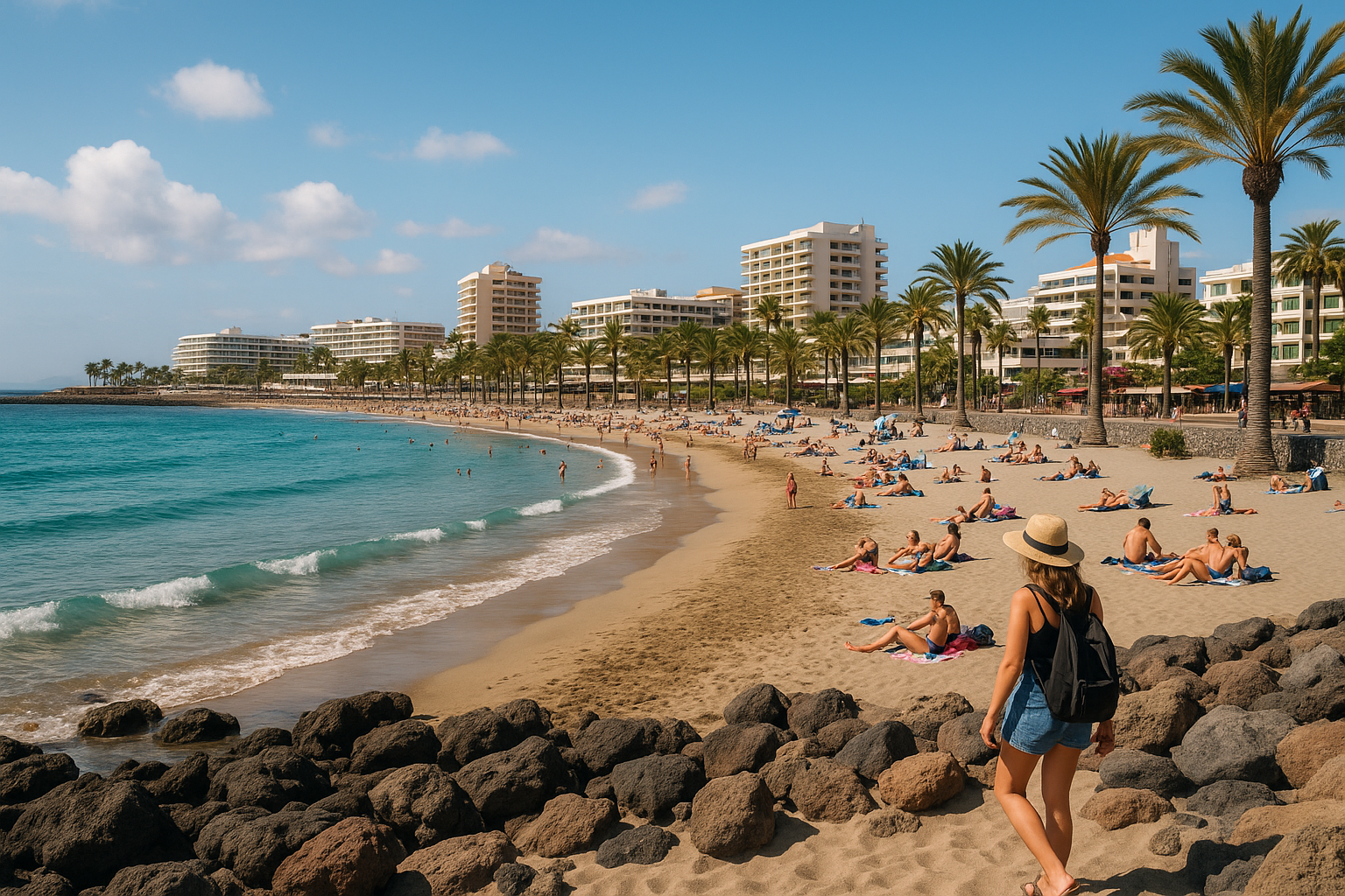
These islands tend to be drier and are famous for beaches and resorts.
Quick Travel Tip:
When looking at a map of the Canary Islands, the eastern islands are usually easier to combine in one trip because they are closer together.
Because the weather can change quickly while navigating the city on foot, some travelers keep their phone protected in a waterproof pouch like this one so they can still check maps even during rainy walks.
Map of the Canary Islands: Tenerife vs Gran Canaria
Two of the most popular islands on a map of the Canary Islands are Tenerife and Gran Canaria.
Tenerife
Tenerife is the largest island and home to Mount Teide, Spain’s highest peak. It offers a great mix of beaches, volcanic landscapes, hiking trails, and lively towns.
Gran Canaria
Gran Canaria is known for its diverse landscapes, including dramatic sand dunes, mountains, and vibrant resort areas.
Best For Comparison
Tenerife
• Volcano adventures
• Diverse landscapes
• Famous national park
Gran Canaria
• Beach resorts
• Sand dunes
• Vibrant nightlife
Map of the Canary Islands: Fuerteventura vs Lanzarote
Looking at a map of the Canary Islands, you’ll see that Fuerteventura and Lanzarote sit closest to Africa and share similar desert-like climates.
Fuerteventura
This island is famous for long stretches of golden beaches and incredible wind conditions for water sports.
Lanzarote
Lanzarote is known for its dramatic volcanic scenery and unique lava landscapes that feel almost otherworldly.
Best For Comparison
Fuerteventura
• Endless sandy beaches
• Windsurfing and kitesurfing
• Relaxed island vibe
Lanzarote
• Volcanic national parks
• Unique black lava landscapes
• Art and architecture
Map of the Canary Islands: The Quiet Western Islands
When studying a map of the Canary Islands, the smaller western islands often get overlooked by tourists — but they are some of the most beautiful.
La Palma
Nicknamed the “Beautiful Island,” La Palma is famous for forests, volcanoes, and incredible stargazing.
La Gomera
A paradise for hikers, this island features deep valleys and ancient cloud forests.
El Hierro
The smallest island in the archipelago, known for diving and peaceful villages.
These islands are perfect for travelers who want a quieter side of the map of the Canary Islands.
How Far Apart Are the Islands on a Map of the Canary Islands?
One of the most common questions travelers ask when looking at a map of the Canary Islands is how easy it is to visit more than one island.
Fortunately, island hopping is very possible.
Typical travel times
• Ferry between nearby islands: 1–3 hours
• Flights between islands: about 40 minutes
• Tenerife and Gran Canaria are major travel hubs
Using a map of the Canary Islands helps you see which islands are closest and easiest to combine.
For example:
• Lanzarote + Fuerteventura is a popular pairing
• Tenerife + La Gomera works well
• Gran Canaria + Fuerteventura is also easy
Getting around the city is fairly straightforward thanks to its extensive public transportation system, and many travelers like using a secure phone holder like this one so they can easily follow navigation directions while walking or riding around.
Why the Map of the Canary Islands Matters for Trip Planning
Understanding the map of the Canary Islands can completely change how you plan your trip. Many travelers assume the islands are similar, but in reality each island offers a completely different experience. Beaches, volcanoes, hiking trails, quiet villages, and vibrant resort towns are spread across the archipelago. Studying the map of the Canary Islands helps you choose the right island for your travel style and even combine several islands into one unforgettable adventure. Whether you’re planning a beach escape, a hiking trip, or a volcanic adventure, the map of the Canary Islands is the key to discovering which island will make your trip truly unforgettable. 🌴✈️


Share your thoughts with us! Leave a Comment!